services
Mapping
JMS Geomatics uses survey grade GPS, Robotic Total Stations and Scanning Lasers for our ground based mapping. We also use UAVs/Drones and integrate other data sets like Lidar and existing orthophotos into the process.
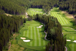
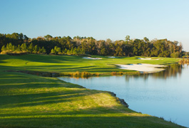
Aerial photos
UAV/Drone mapping
JMS Geomatics uses UAV/Drone technology to capture imagery that is used to generate orthophotos and terrain models in the United States, Europe and Asia. We also capture video fly throughs of your course.
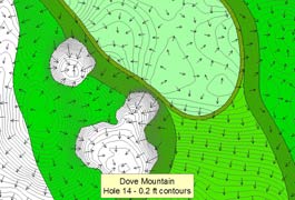
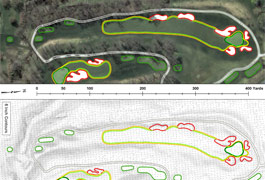
green scanning
Collaborating with Mark Long, our green mapping is used by PGA Tour players and caddies during tournaments. Our data has also been used by golf course owners, superintendents and architects for historical documentation, slope analysis and renovations.
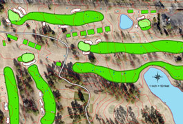
GIS CAD WORK
JMS Geomatic's GIS and CAD work is used by the PGA Tour for their ShotLink scoring system. Files are also used by EA Sports, golf course architects, superintendents and irrigation consultants.
Topography
JMS Geomatics has an extensive library of topographic data throughout the United States, and combine that with our ground based mapping to generate detailed 3D models and contours of your course.
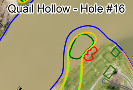
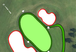
Area Calculations
Using survey grade GPS and Robotic Total Stations we are able to provide very accurate square footages of greens, tees, bunkers, fairways, water features, etc
Irrigation As Builts
Formatted for central control software packages.
Yardage Books
JMS Geomatics data is used to generate customized yardage books.
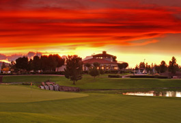
Photography
JMS Geomatics uses professional photographers to create beauty, reference and object photos for our clients.
navigate
- About Us
press
contact
JMS Geomatics, Inc
Oro Valley, Arizona • USA
520-797-0773